Marderello
The Marderello catchment is located in the north-western Italian Alps as an east tributary to the Cenischia valley. It has a catchment area of 6.61 km² where the upper basin altitude is at 3538 m a.s.l. at the Rocciamelone Mt. and reaches down to the village Novalesa at an altitude of 900 m a.s.l. with an average slope gradient of 60%. Frequent mud flows and debris flow events occur at this catchment so first monitoring activities started in 1994 and in 2013 the monitoring system was improved. The equipment at the site includes one ultrasonic gauge, two rainfall stations, three video cameras and four geophones. From 2015 to 2018 the detection system based on a Chaparral Model 24 infrasound sensor and a geophone of the type Sercel SG-5 was installed at the lower part of the catchment close to the indicated monitoring Station 1 in Figure 1. On regional distinctions of this test site is the cascade which is about 450 m upstream to the monitoring station.
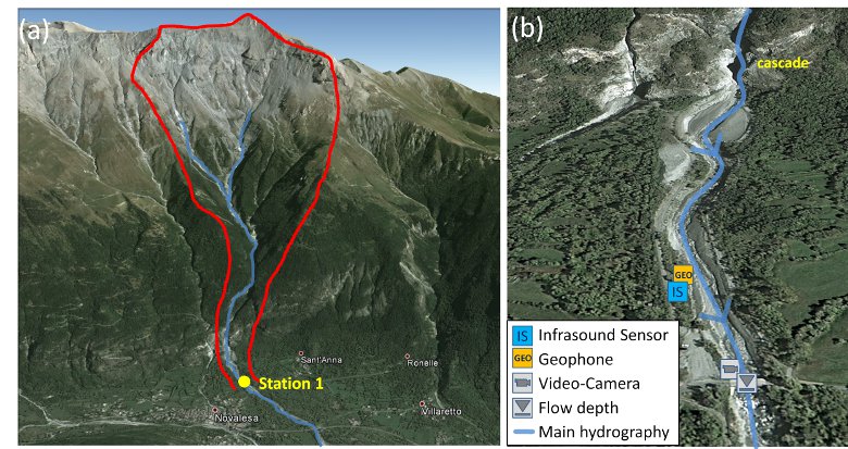
Fig. 1: (a) Overview of the test site Marderello (red line: catchment area); (b) Closer view of the monitoring Station 1 and sensor setup (Source: Google Maps).