Rio Gere
The Rio Gere basin is part of the Bigontina catchment, which has a surface of 17.5 km² extending from 3221 m a.s.l. (summit of Cristallo peak) to 1150 m a.s.l. at the confluence with the Boite river near Cortina d'Ampezzo (Belluno, Italy). The Rio Gere has a catchment area of 1.68 km² and joins the Bigontina channel at an elevation of 1650 m m a.s.l. close to the Passo Tre Croci. In cooperation with the Dipartimento di Scienze Biologiche, Geologiche e Ambientali, Universitá di Bologna a MAMODIS station together with a raspberry camera has been installed in the lower part of the channel in 2021 beside the existing monitoring station of UNIBO which consists of a rain gauge, several time-lapse cameras, and geophones.
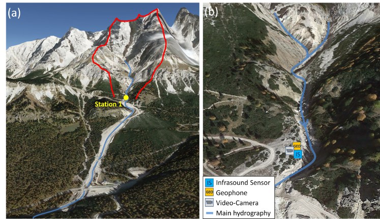
Fig. 1: (a) Overview of the test site Rio Gere (red line: catchment area); (b) Closer view of the monitoring station and sensor setup (Source: Google Maps).